ChatGPT Image
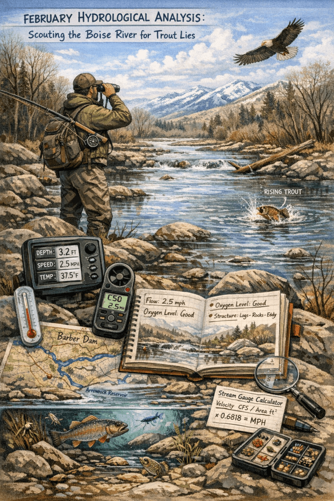
February is the best time of the year to scout for fishing holes. It’s cool during the day here in Idaho, around 50 on a warm day, and you can exert lots of energy without overheating. The water is low, so structure and cover are exposed along the bank. Scouting is the part of fishing that no one really talks about. Most people show up to a spot mid-summer and get skunked, others refuse to get skunked, so they rotate spots until they give up (another form of scouting) before having ever looked at the water.
I’m not saying that these old, tried and true techniques don’t work. What I’m talking about is a system where the angler shows up, determines if the spot is viable through metering and gauging the environment, reading the water, watching for signs of fish activity, while logging the state for future reference. The angler then builds a knowledge base where they will no longer have to log, but simply reference.
When I was a senior in high school, a group of guys and I decided we were going fishing. In the Texas Panhandle, water is scarce, so we had only a handful of options. So, we all gathered up our poles, and set out for the nearest quarry. As we fished, we all kept asking, “Are there even fish in here?” My guess to this day is no. Several years later, after moving to Idaho, I learned that quarry water is usually high in minerals, making life deeply dependent on the water’s physical state—pH, mineral content, etc. This is an example where water test results would prove significant when scouting. Had we known there were not fish in there, we would have chosen a more obvious place to fish, like a stocked pond.
To further understand why scouting is important, let’s take a look at an example that shows fish caught in angling hours.
“From June 2007 through June 2008 anglers were surveyed along the river from Barber Dam to America Boulevard Bridge. During the creel survey, 1350 anglers were interviewed and nearly 700 angler counts were conducted on 109 separate dates. Anglers spent an estimated 33,056 hours fishing [this part of] the Boise River during the year. 89 percent of the fishing effort consisted of anglers using bait and lures. Rainbow trout comprised the bulk of the catch, said Butts. The average catch rate for rainbow trout was 0.6 per hr. During the survey, 20,704 rainbow were caught and of those, 4,277 were harvested. Nearly 80 percent of the rainbow trout caught in this section of the river were released even though harvest is legal in most of this section. Brown trout were caught less frequently, and the average catch rate was 0.01 fish per hour, [or 1 fish every 100 angling hours,] which resulted in an estimated of 330 fish caught throughout the [(year)] survey period.” Fly Fisher’s Guide to Idaho 4th ed., Ken Retallic and Rocky Barker, Wilderness Adventure’s Press, 2018, pg. 204
What this means is that location selection matters more than miles coverage. Where this can get speculative is assuming uniform cross-sectional area. Rivers don’t behave like pipes. A 10 ft average depth doesn’t mean the current is uniform across that width. The top half of the water in a river can flow half the speed of the top due to a rocky bottom.
A nomadic angler will typically cover vast amounts of area, but if there isn’t a fish for a tenth of a mile, because the water is low in dissolved oxygen, too hot or cold, or void of food, then there is no reason to cast in this area. On highway 55, here in Idaho, the road passes by a stretch of water that is completely silt. A myth stands, proclaiming there isn’t viable life in silt, so anglers should pass by. However, combined with low flow, clear waters, and shallow depth, an angler may be able to visually see there are no fish in that particular section of water.
Speed of water is a huge dictator of where life resides and how much of it resides there. If the water is flowing too high, then insects like dragonflies and water boatman won’t be as present. These insects need slow water, ~0-20 cm/s, or ~0.45 mph, as they are swimmers or active hunters that a current would cause too much energy to overcome and survive. Areas like ripples are going to be higher in caddisflies, mayflies, and stoneflies. Their bodies are adapted for higher CFS, 15-100+ cm/s, or 0.34 – 2.24 mph. They use anchors (mayflies and stoneflies use hooks and caddisflies use silk nets) to stay stabilized in the high flow.
The Boise River can reach levels above 5000 CFS, when the river is 100 ft wide x 10ft deep 5000 CFS computes to ~3.41 mph. This amount of water squeezed through a canyon at half the width but the same depth would double the rate to 6.82 mph, and inversely, if the river section is 2 times that, then it would slow to half, or 1.7 mph.
To calculate start with the formula:
velocity (ft/s) = flow (CFS) ÷ area (ft²)
Then convert feet per second to miles per hour:
mph = (ft/s) × 0.681818
So, the full chain becomes:
mph = (CFS ÷ area) × 0.681818
In our example:
(5000 ÷ 1000) × 0.681818 = 3.41 mph
The idea is to find the prime speed of water and present the fly, so it sits natural in the environment. This, though, is the speed of the lane that the fly travels, not the entire river section.
One of the most important tools I have in my scout pack is a range finder with a velocity meter. If I pass my sonar over the area, get a depth, then find the width of the stream, I can compute the speed of the stream in mph. This gives me a final determination of speed. After this I can get a sense of safety, “can I pass through without being swept away?” Or I can get practical information. “Is the speed of the water too fast to hold fish? Is it too slow?”
Many anglers don’t know that stream velocity is one of the levers that determines dissolved oxygen (DO) rates, something that fish seek out before food. Stream velocity increases oxygenation primarily through turbulence and surface area mixing, not just speed itself. A slow creek can still have high DO if cold and well shaded. On a slow creek, a small waterfall followed by shade can be very productive. Here in Idaho, a stream can go hundreds of yards before passing through trees, heating several degrees. Without the rocky beds, the water would heat, lowering DO. Fish will not fully inhabit an area where they cannot breath, and a slow running creak can be low in DO, so fish tend to avoid that area. This is why thermoclines, waterfalls, ripples, and eddies are all highly productive areas to fish, but not because they just create DO, but because they line with the fish’s needs: DO, food, shelter.
Water speed (and, yes, temperature) affects forage and insect populations, so being able to eye water moving at 0.5, 1, 2, mph, will allow me to choose better locations. Imagine having a three-day window to fish the Patagonia, New Zealand, or Japan. Day one: scout, day two: fish, day three: focus. No catch is guaranteed. Reading the water is 90% of scouting.
I was out last year, on the Boise, and there was a rainbow taking flies off the surface. I only had my 8wt, and the fly was an experimental rubber worm made from a large rubber band on a 1/0 hook. I was out for smallmouth, but I should have prepared for trout too. I should have had my second rod, my 5 or 6 wt. But I cast out with the 8. I firmly believe that the fly hitting the water scared the fish, even though it was upriver 3 or 4 yards. If I’d had my trout box and a lighter rod, I would have had a better chance of success through lighter gear selection. The deeper water was moving at about 3.5 mph, a brisk pace, but the water, where the trout fed, ran less than half. If I would have had a lighter fly, then I could have cast out 5 or 10 yards and wait for the fly to intercept the fish. But I wasn’t prepared to target that type of fish.
With my 8wt gear, I should have checked my fly boxes, found the smallest fly (something smaller than the #4), and rigged a 12ft leader. Then the 8wt would have worked perfectly for a stealthier approach. Plus, that would have extended my reach by another meter. Instead, adrenaline flowed and I impulsively cast out, spooking the trout. This is why patience is needed, why the long game works, and overthinking steps to the point you are seemingly predicting the future.
On the other hand, when I visited the Islands of Oahu and Molaka’i, I brought everything needed to cover every level in the water column. We spot hopped all day for a week, covering two islands (basically just scouted). I was stuck rigged with top water or spend time changing to sink-tip. My sinking line was never even spooled on the reel from a swap box. I planned to fish for jacks, barracuda, and bonefish, but when I arrived, I was left with split second decisions that were doomed from the beginning because I had never fished in waters so complex and intimidating. To an angler who has only fished freshwater, the surf can be a divine force. The only scouting I was able to do was my recollections from my first vacation to the big island, and Google Earth. Though freshwater fishing is not as extreme, it can be as daunting. But the point still stands: I had to scout the area before even knowing what to rig.
Scouting the waterline in February will allow me to grow into the season. I can fish more aware, more cognizant of where and when I cast a line. My article Ancestral Machinery: Why Fish Behave the Way They Do, https://madanglerhub.com/2026/02/01/ancestral-machinery-why-fish-behave-the-way-they-do/, explains why fishing is more than walking up to the river, hoping the fish don’t just see you, but why stealth is needed. Fish can feel the ground thump, they feel pressure waves and have a sudden neural reaction when the Mauthner neurons are upset, triggering an instantaneous escape.
The survey studied ~6.3 miles of the Boise River. This year, and during the writing on the book, I am covering a 0.73-mile section of water.
If browns are caught at a ratio of 0.01fish/hr over 6.3 miles, then we can calculate by cross multiplying.
(Old Fish Per Hour × Covered Section of Water) ÷ Total Section of Water = Fish Per Hour
(0.01 × 0.73) ÷ 6.3 = 0.00115873
Here we see that the 0.73 miles equates to 0.001159 fish per hour, or 1 fish every thousand hours of angling time. But this is according to the 2007 survey and assuming the population scaled to today’s populations.
With this in mind, we can see that it is very important to find the fish, before casting into the water. Anglers of all types feel that time is of the essence (but it’s the patience that hooks the fish). This is the skill behind fishing: scouting or simply reading water—a hydrological analysis for anglers. Determine stream flow rates. Crunch the numbers before hitting the water with the rod. Calculate out the actual time needed to catch the target fish, and anything beyond that is a bonus.
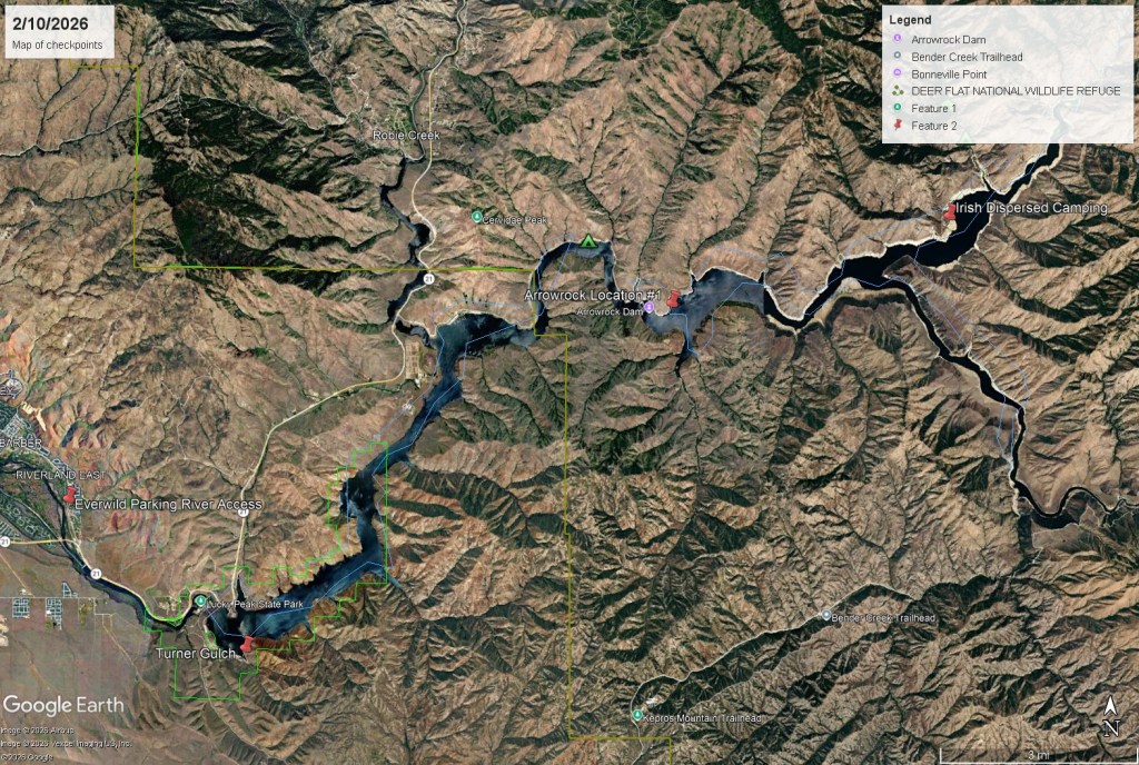
Lakes however are different, and for this experiment, I raced up the canyon to Lucky Peak State Park. The first stop, Barclay Bay. The temp read 38.5-degrees. This is cold, but a sure sign the water is warming up. I have seen this part of the lake still partially frozen in February. The next stop, location #1 at Arrowrock. This is a great location. It’s deep and goes out to a point. I have fished in this area and did well for myself. It’s next to the dam, which made this spot really interesting, as the thermometer showed 39-degrees. The next stop, the mouth of the Boise into Arrowrock, but as I travelled up the watershed, I saw ice was still melting. Holes riddled the ice were the sun warmed and a light blanket of snow still covered the ice in the shadows. I turned around after concluding the water to be 32-35 degrees. I didn’t have a map so I didn’t know how much longer I would have to travel before getting to the mouth. I made it about ten minutes past Irish Dispersed campground, before turning around and taking the temperature at that location.
Lakes can have different turn over rates:
Polymictic – mixes frequently, weak or absent thermocline.
Holomictic – mixes completely at least once per year (broad category).
Dimictic – mixes twice per year, stable summer thermocline (deeper lakes).
Monomictic – mixes once per year.
Meromictic – does not fully mix (rare, chemically layered).
These are the core profiles that label the lake’s turnover rates. The turnover rate is what will determine the temperatures of the lake and tailwaters throughout the season. This means that throughout the year the water will be holding fish in various spots.
Now this all may be obvious, but the key that I want to point out is: if an angler is to know the water state beforehand, then he will be able to better predict where the fish are upon arriving at the water the next time. This is why I traveled up the waterline, from Barber Dam to Arrowrock-Boise River mouth, taking temperatures, to find where the hot spots are and where to go next time, when I’m needing to scratch the itch.


Arrowrock
https://water.usace.army.mil/overview/nww/locations/ark
Lucky Peak
https://water.usace.army.mil/overview/nww/locations/luc
Looking at my readings:
| Date | Location | Water Type | Depth | Temperature |
| 2/2/2026 | Everwild, Lower Boise River | Tailwater | 3ft | 37.5 F |
| 2/3/2026 | Upper Barber, Lower Boise River | Tailwater | 1ft | 38.5 F |
| 2/10/2026 | Turner Gulch, Lucky Peak | Reservoir | 1ft | 38.5 F |
| 2/10/2026 | Loc #1, Arrowrock Dam | Reservoir | 1ft | 39.5 F |
| 2/10/2026 | Irish Dispersed Camping, Arrowrock | Reservoir | 1ft | 38 F |
We can see the reservoir state by looking at the US Army Corps of Engineers data and comparing the temperatures and locations: Arrowrock is at 82%, and Lucky Peak is filled to 36%. With Arrowrock being full, the question was, “has it had some time to heat the top layer of the lake nearest the dam?”
Water draining from the lake is pulled from the bottom, while the water in the upper column is heated. Arrowrock’s deep water reserve has created an insulated layer of warm water near the surface. By my records, the sun has heated a pocket of warm water, which is 39 degrees. This is called thermal stratification, and the top pocket is called the epilimnion. Below the epilimnion is the thermocline and below the thermocline is the hypolimnion. A lake needs 4-degrees difference to develop a thermocline. Even though Arrowrock has not warmed significantly, it might have developed a thin thermocline over the abnormally dry winter. Stratification is from the warming temperatures contrasting with the cold headwaters, an ecological state that is apparent even so early in the season.
Finding hot spots in the lakes, scouting for structure and cover, and fishing slowly are some of the measures that an angler must take to accurately angle for fish in the later cold months. This type of scouting during the cold, late winter months, depends on finding hot spots, determining where the sun is heating the lake, and fishing the warmer water. If the water coming from the reservoir is 38.5 degrees, like the reading at Everwild, but the water above it, and above any hypomilion or thermocline, like Lucky Peak, is 38.5 degrees, then there is not a separation of water, or stratification, because there is not a thermal difference. When comparing the water from Arrowrock to Lucky Peak, near the dam, we see it lift from 38.5-degrees (near Lucky Peak Dam) to 39.5-degrees. This gradual increase will continue throughout the year.
Note: I waited a week for warming conditions before measuring the lakes, typically, the water coming from these reservoirs is not going to fluctuate over a week. If there was a sudden downfall or snowfall, I would expect the temperatures to fall, especially after a long period of sunshine.
Measuring the water column temperatures, measuring the speed of the water’s flow, and measuring the fishing rates (even if they are your own), can give an angler a very basic idea of the water they are fishing, but it forms a viable map for where to cast.
References
Fly Fisher’s Guide to Idaho 4th ed., Ken Retallic and Rocky Barker, Wilderness Adventure’s Press, 2018.

Leave a comment